Early thoughts on the new Trek2There app from Esri Labs
In mid-October, Esri Labs published a new app called Trek2There for iOS and Android. It is a simple app with little functionality; however, it does something clients ask us about from time to time. How do I navigate to a location with Collector?
The answer is you can’t, for both Collector and most Mobile GIS apps.
But now my answer will be, you can with Esri’s Trek2There, but it isn’t super functional right now.
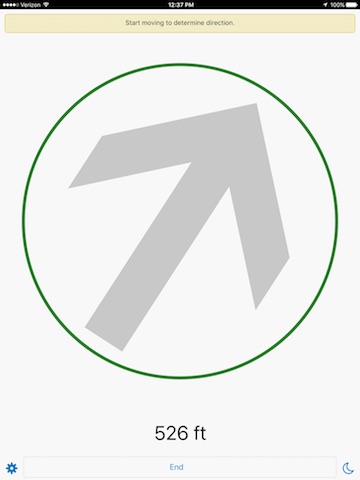
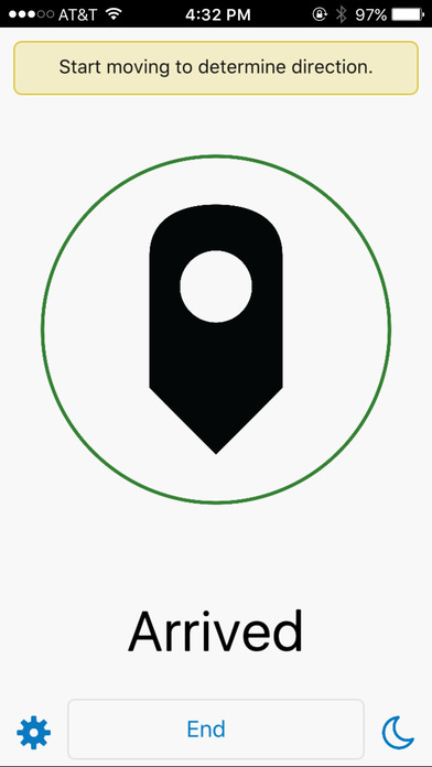
I actually love this simple app as it will allow field users to enter the coordinates of a location they want to get to and tell the distance and direction that they need to travel to reach their destination. If you are using a submeter Bluetooth GNSS, then the Trek2There app will be more accurate. Simple but effective if that is your offroad need as it will not provide street turn-by-turn directions, they have Navigator for that.
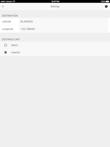
Now more about Trek2There. The caveat is that it only allows you to enter location coordinates based on WGS84 and they need to be either hand-typed in or you need to launch this website on your mobile devices web browser https://esri.github.io/Trek2There/Trek2ThereWebLauncher.html
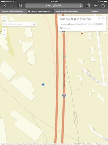
If you go with the web browser option, you can zoom to where you are and choose a location by tapping the screen. A pop-up like the attached screenshot will show and allow the user to open Trek2There and begin navigating to that location. That is fine and dandy, but not the way I foresee most users taking advantage of this app.
I envision a field user that needs to find existing assets at a project site that requires hiking or off-road driving, such as finding existing wells, bird nests, archaeological sites, pipe valves, etc. The caveat is that the users need to have the location of all those assets to revisit formatted in WGS84 datum and decimal degrees latitude and longitude. Then the user can type in the coordinates of each asset in Trek2There and navigate to it and conduct their monitoring work, and then type in the next location and repeat.What I would like to see in the immediate future is the ability to load a simple spreadsheet with the ID, latitude, and longitude formatted correctly to the Trek2There app and then be able to just click on each location ID and navigate to it without having to manually enter all the locations. Or better yet, the ability to use Collector to select an asset and then tap the option to open in Trek2There. And finally, the best would be this functionality built into Collector as an extension of the accuracy display box in the lower left corner of the Collector 10.4 app.
I would expect there to be the potential for the Esri Labs group to test new functionality in little apps like this for later inclusion with their workhorses like Collector, Workforce, Survey 123, or Navigator. If this is the plan going forward, then it will be important for Mobile GIS users to test this Trek2There app and future Esri Labs apps and provide feedback to them if you ever want to see these types of functions incorporated with their main mobile apps.
I look forward to seeing more simple idea testing apps like this from Esri Labs!
For iOS: HERE
For Android: HERE
Tagged Products