

Vermont Gas Systems Doubles Efficiency with Arrow Gold's and iPads
Posted by AGS on 11/20/2020 to
Client Success Stories
Vermont Gas Systems Arrow Gold Adoption Success
"For us, high accuracy GPS and mobile GIS is an essential tool. It will become as prevalent as fire extinguishers and leak soap; another tool in an employee’s toolbox to help them

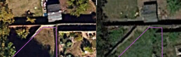
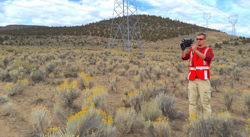
National Park Service Tackles High-Accuracy Problems with Arrow Golds
Posted by Guest: Tim Smith on 4/21/2020 to
Client Success Stories
How GNSS Data is Helping a National Park Clear Snow from Unmarked Alpine Roads One of Anatum's Client's Gets Creative!

Missouri Trails Project Finds Mapping Success with Eos Arrow 100
Posted by Guest: Josh Adams on 8/8/2019 to
Client Success Stories
Missouri has thousands of miles of trails for walking, biking, equestrian, and motorized activities. To better map the trail locations, we decided to implement the use of Esri's Collector app paired with the Eos Arrow 100 for its high accuracy. Within the first year, the database has grown from 600 GIS miles to 6,200 miles through a collaboration of various trail managing agencies throughout Missouri.

GPS Technology Discussion with ArchaeoTech Podcast
Posted by Matt on 6/16/2019 to
Adopting Mobile GIS
Recently I had the pleasure of being a guest on the Archaeology Podcast to discuss today's GNSS technology. Give it a listen to learn more about the current state of GPS and GNSS technology and how it relates to archaeology in the field.
Advanced Mobile Mapping Series: Why Does My GPS Data and Imagery Not Line Up?
Posted by Matt on 6/10/2019 to
Adopting Mobile GIS
Why your GPS data doesn't line up with your aerial imagery is a common question. This article discusses the various reasons for this discrepancy.
Updating Your Mobile OS: The Double-Edged Sword of Updates
Posted by Matt on 5/10/2019 to
Adopting Mobile GIS
This article is aimed at the question of updating or not updating the OS for your mobile mapping device. Ideally, we could all update our devices used for mobile mapping without worrying about any unforeseen software bugs, but that just isn't the case. There will always be the potential for a software bug to inhibit our ability to collect field data with our mobile device. This article focuses on the best practices for determining when and if to complete an OS or mapping software update.
Diverting Your Paper Stream to Cloud-based Wetland Reporting
Posted by Guests: Anita Henry and Nancy Douglas on 3/9/2019 to
Adopting Mobile GIS

Check out Wildnote's electronic wetland determination forms formatted for all 10 USACE regions!
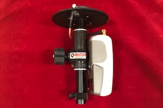
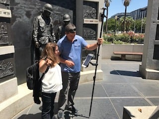
Faster Setup and Breakdown Times For Your Pole-Mounted Arrow Receivers!
Posted by Matt on 1/10/2019 to
Adopting Mobile GIS
Tired of slow setup and breakdown times with your pole-mounted Arrow receiver? Do you have to get in and out of your truck multiple times a day?
Try our new Quick-Release Kit to make setup and breakdown easier and faster than ever!

The Value of Mobile GIS and the Power of Cloud Computing in Natural Resource Management
Posted by Matt on 7/4/2018 to
Adopting Mobile GIS
Using Mobile GIS equipment and workflows with cloud computing can streamline data collection and management for field staff and allow managers to make more timely and informed land management and conservation decisions. These workflows also greatly increase the efficiency of reporting. Not only can these solutions save man-hours and money, but also reduce potential human errors introduced by recording field data on paper and then having to manually enter that data into a computer database.

Fast Field Work: Collector for ArcGIS and High Accuracy GPS
Posted by Matt on 4/9/2018 to
Adopting Mobile GIS
Sulphur Springs Valley Electric Coop transitions to Moblie GIS with iPads, Arrow Gold RTK receivers, and Esri Collector for ArcGIS to update the location accuracy of more than 34,000 assets in less than two months time! Learn more about how the accomplished this feat.

Everything You Need to Know About GPS for Switching to Mobile GIS
Posted by Matt on 1/15/2018 to
Adopting Mobile GIS
This article will break down the nitty-gritty of today’s GPS equipment and how to use the newest Bluetooth-enabled GPS receivers with your phone or tablet to get the best out of your Mobile GIS field data collection.
It was originally published in the Fall 2017 Volume 10 Issue 1 of BayGeo Journal.
Matt and Esri Co-teach Collector Workshops
Posted by Matt on 6/28/2017 to
Adopting Mobile GIS
Anatum's very own Matt Alexander teaches the technology portion and explains GPS technology and user best practices alongside the Esri staff with their focus on Collector for ArcGIS.
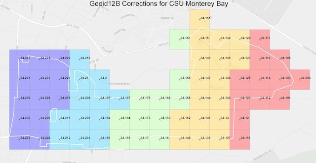
CSU Monterey Bay Tackles High-Accuracy RTK and Elevations with Collector
Posted by Matt on 5/19/2017 to
Adopting Mobile GIS
To capture horizontal (horizontal datum NAD83) and elevational data (vertical datum NAVD88), the university needed to determine first the required accuracy and if there was an affordable technology solution that could accomplish the task. By working with the GNSS experts at Anatum Field Solutions and their review of Bluetooth GNSS options, the EOS Arrow 200 RTK-GNSS using Esri’s Collector app, paired with an existing campus base station transmitting centimeter-level RTK corrections via the Internet, met all requirements for horizontal accuracy.
However, they needed to capture the vertical datum in NAVD88. This explains the differences between Height Above Ellipsoid captured by Mobile GIS apps and how to convert that elevation data to MSL (NAVD88).

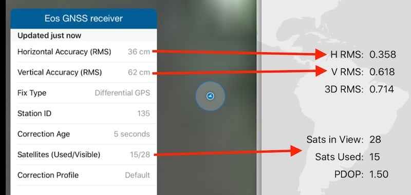
Adding GNSS Metadata Fields for Esri Collector
Posted by Tyler on 5/11/2017 to
Adopting Mobile GIS
Users can now power up their Esri Collector with automatic GPS satellite metadata fields collection. Use Collector to capture horizontal & vertical accuracy from your external GPS or GNSS receiver.

Are You Taking Full Advantage of Your Esri Software?
Posted by Matt on 4/10/2017 to
Adopting Mobile GIS
Ready to move from old-school GPS handheld data collectors to high-precision tablets? Ready to work in real-time between field collection staff and office management? Already an ESRI ArcGIS user? Get ready to learn how Mobile GIS can make your life easier and more efficient!
Are Rentals a Better Deal Than Buying?
Posted by Matt on 2/9/2017 to
Adopting Mobile GIS
Is Renting your field equipment like GPS and rugged tablets a better financial decision than buying?
Well, that depends, but the answer is likely Yes.

What is NTRIP?
Posted by Tyler on 2/7/2017 to
Adopting Mobile GIS
This article breaks down the explanation of how RTK and NTRIP work to get field users centimeter level accuracy in real-time.

Anatum's Expertise Displayed in ESRI Newsletter
Posted by AFS on 12/19/2016 to
Adopting Mobile GIS
Anatum’s depth of experience working with Esri’s Collector and GNSS Equipment for Mobile GIS Solutions for enterprises was published in Fall 2016 edition of Esri News for Water & Wastewater

Adopting Mobile GIS
Posted by Matt on 10/17/2016 to
Adopting Mobile GIS
Adopting Mobile GIS Solutions
Important lessons learned from six years of implementations and thousands of hours in the field.
ESRI's Trek2There App
Posted by Matt on 9/2/2016 to
Adopting Mobile GIS
Esri's free app Trek2There is a simple app with little functionality; however, it does something clients ask us about from time to time. How do I navigate to a location with Collector?
ESRI Collector Supports High-Precision GNSS
Posted by Matt on 6/1/2016 to
Adopting Mobile GIS
Esri has been chasing the rest of the mobile GIS app world for a long time. But, with this summer’s update that adds on-the-fly datum transformations, Collector catapults itself above almost all competitors in the GNSS interface category. We are excited to spend more time in the Collector work flow with RTK equipment, but hope that Collector continues to develop additional functionality to keep up with competitors that have more robust data forms.
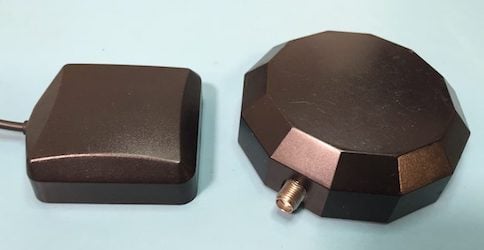
Mobile GIS: What to do with a GPS Antenna?
Posted by Matt on 3/17/2016 to
Adopting Mobile GIS
One of the things professionals have to get used to when they switch from submeter handheld GNSS equipment to mobile GIS workflows with submeter GNSS receivers is their antenna. The important thing to keep in mind is the antenna needs to “see” as much sky as possible and preferably at all times. Below we present a few methods for working with the external antennas used with Bluetooth GPS and GNSS receivers.
Arrow GNSS Interface App
Posted by AFS on 3/1/2016 to
Adopting Mobile GIS
At Anatum Field Solutions, our group prides itself on being both agnostic to equipment manufacturers and using this equipment in the field. We don’t do as much field work as we did working as biologists and environmental consultants before we started this company, but we still do a lot of field testing of equipment both independently and with our clients around the United States.

Bluetooth GPS/GNSS For Mobile GIS Field Tested and Compared
Posted by Matt on 2/18/2016 to
Adopting Mobile GIS
As an agnostic reseller and rental company of GPS equipment for use with Mobile GIS workflows, it is important that we know how the market performs. There are a multiple Bluetooth-capable GPS and GNSS receivers on the market now and we tested and compared them in real-world settings on our GPS Test Course. These field tests compared the accuracy and precision of Bluetooth submeter-rated GNSS receivers under conditions that ranged from open-sky to heavy canopy cover.
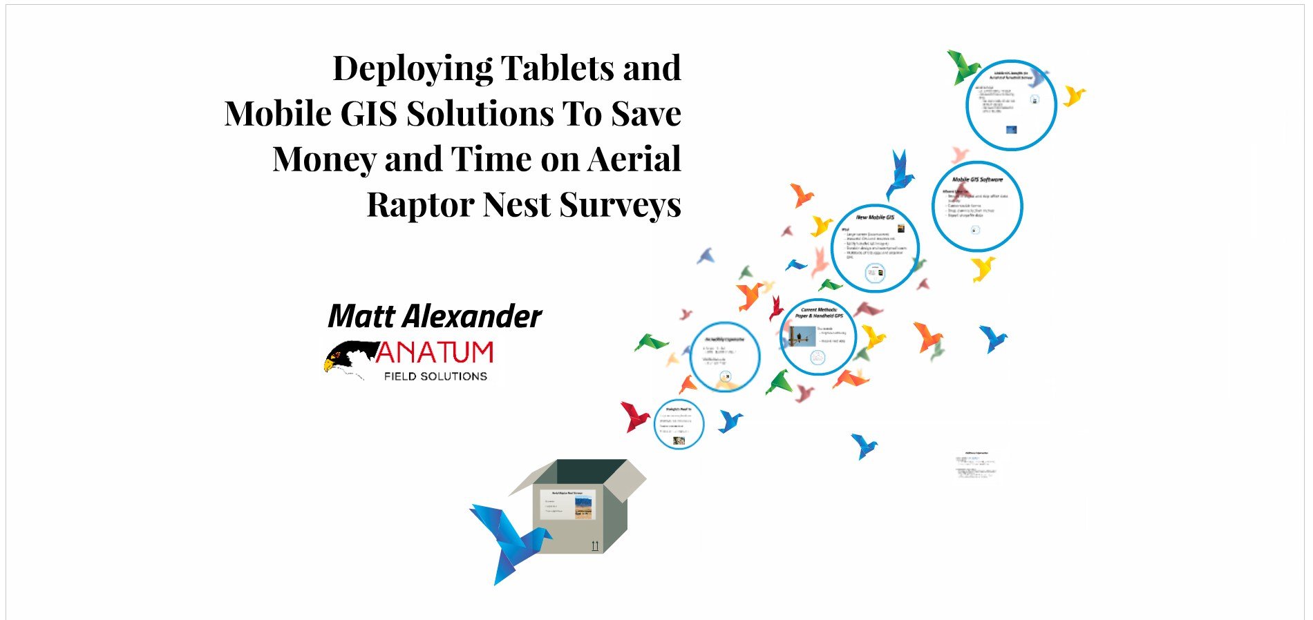
Using Tablets For Data Collection to Increase the Efficiency of Aerial Surveys
Posted by Matt on 1/18/2016 to
Adopting Mobile GIS
Recent technological advancements in the form of tablets with mobile GIS software paired through Bluetooth with external GPS receivers are providing new opportunities to aerial surveyors that can substantially increase efficiency and accuracy while simultaneously reducing potential impacts to wildlife. GPS receivers that we have used include the Arrow 100 for submeter accuracy and the Bad Elf GPS Pro with 2.5-meter accuracy. The appropriate GPS receiver depends on your projects accuracy requirements.
