
Bluetooth GPS/GNSS For Mobile GIS Field Tested and Compared
Posted by Matt on 2/18/2016 to
Adopting Mobile GIS
As an agnostic reseller and rental company of GPS equipment for use with Mobile GIS workflows, it is important that we know how the market performs. There are a multiple Bluetooth-capable GPS and GNSS receivers on the market now and we tested and compared them in real-world settings on our GPS Test Course. These field tests compared the accuracy and precision of Bluetooth submeter-rated GNSS receivers under conditions that ranged from open-sky to heavy canopy cover.
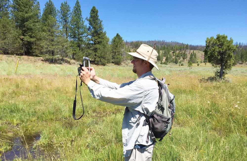
Using Tablets For Data Collection to Increase the Efficiency of Aerial Surveys
Posted by Matt on 1/18/2016 to
Adopting Mobile GIS
Recent technological advancements in the form of tablets with mobile GIS software paired through Bluetooth with external GPS receivers are providing new opportunities to aerial surveyors that can substantially increase efficiency and accuracy while simultaneously reducing potential impacts to wildlife. GPS receivers that we have used include the Arrow 100 for submeter accuracy and the Bad Elf GPS Pro with 2.5-meter accuracy. The appropriate GPS receiver depends on your projects accuracy requirements.
Using Tablets in the Field: A Case Study
Posted by Matt on 1/18/2016 to
Adopting Mobile GIS
Based on the results of our 2013 and 2014 case studies, we found the quality of data from using the mobile technology likely improved by eliminating potential errors introduced during the manual transfer of data from paper datasheets to an electronic database. The efficiencies gained in the documentation and distribution of the data resulted in substantial cost savings, even when considering some of the upfront costs of training and pre-survey preparation of automated data forms and creation of the Project specific GIS data in the mobile GIS app system. In addition, this technology is extremely adaptable and can be applied to survey data in a variety of disciplines aside from biology, including documentation of cultural resources surveys, geotechnical data, and other engineering data that may be needed for the Project.

EOS Arrow GNSS Receiver Interface App Tutorial
Posted by AFS on 1/5/2016 to
Tutorial Videos
Video tutorial for the interface app by Eos for the Arrow receiver product line. Eos Tools Pro for iOS.
Bad Elf GPS Compared to iPhone and iPad GPS
Posted by AFS on 1/4/2015 to
Knowledge Base
We are often asked by friends and clients why they need an external GPS when their phone or tablet already has an internal GPS. We have three answers for that. Click through to see more.

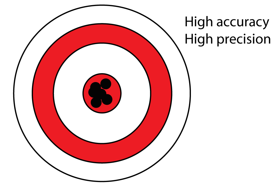
Accuracy and Precision Related to Surveying
Posted by AFS on 12/28/2014 to
Knowledge Base
This article defines both "Accuracy" and "Precision" and how they differ.

GNSS User Best Practices
Posted by AFS on 12/28/2014 to
Adopting Mobile GIS
This article will focuses on the various types of measurement biases and errors can be encountered; some of which is hardware instrument error and some user.

Brief Introduction to GPS and GLONASS
Posted by AFS on 11/16/2014 to
Knowledge Base
This post discusses simplified descriptions of GPS and GLONASS, and a follow-up post will discuss User Best Practices to keep in mind for achieving the most accurate data.
